site.btaSliven Creates Digital Map of All Trees on Its Territory
Sliven Creates Digital Map of All Trees on Its Territory
Sliven Municipality Photo

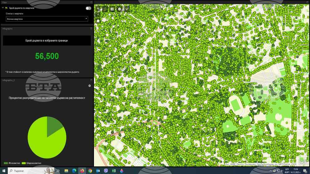
A digital map has been created, which marks all 56,000 trees on the territory of Sliven (Southeast Bulgaria), the municipal press centre reported on Wednesday. The digital model has an accuracy of about 5 cm. Each tree is labelled by species (coniferous or deciduous), height, location.

The Municipality has a modern digital passport of trees in the city, said Sliven Municipality’s Ecology Department Chief Expert Emilia Kyuchukova. "That is the first time we have a complete inventory of tree vegetation. It will make it much easier for us to track and control," Kyuchukova added.

A thermal photogrammetric camera has also been used to analyze the so-called "heat island" effect in certain areas of the city. In November, the Municipality began implementing measures against the so-called "heat islands" through the construction of a green "corridor" between two city parks in Sliven.

During the process, the entire surface of the territory of Sliven was scanned, including the built-up areas. The digital model allows to build on the data during certain periods. This information will be useful in the field of construction and architecture. In the future the map will be implemented in the Geographical Information System of the Municipality.

The capture and preparation of the map was carried out by Aerografika EOOD - Sofia. It costed BGN 34,000, and according to the announcement, the use of drones saved significant funds.

In its governance programme, the municipal leadership emphasized the improvement of environmental indicators and the transformation of Sliven into a "green city".  

/RY/

news.modal.header

news.modal.text

By 10:44 on 24.11.2024 Today`s news

This website uses cookies. By accepting cookies you can enjoy a better experience while browsing pages.

Accept More information